A Proposal of Application Notice is a legal requirement for applicants of larger scale developments that are classified as “major” in the Scottish Planning System. Applicants must give appropriate notice to a local planning authority of their intention to submit a major planning application, including details of a pre-application consultation programme that must be undertaken. Housing developments are classed as major if 50 or more dwellings are proposed or if the area of the development site is equal to or greater than 2 hectares (approximately 5 acres). On 13th May 2022, a Proposal of Application Notice was submitted to Aberdeen City Council’s Planning Service for this proposed development, which has been given the reference 220610/PAN.
GREENFERNS
PUBLIC CONSULTATION WEBSITE
What is a Proposal of Application Notice?
What is the application procedure for this development?
In the first instance, a Proposal of Application Notice was submitted to Aberdeen City Council’s Planning Service, on 13th May 2022, expressing the intention to submit a planning application for this development. For an explanation of Proposal of Application Notice, please see the previous question. As part of that notice, we set out arrangements for the current pre-application consultation programme, in which we are required to give the public details of the proposal and an opportunity to provide feedback. Once the consultation has ended, we will submit a Pre-Application Consultation Report in support of any future application for the development, which will summarise your feedback and explain how your feedback has influenced the proposed development.
Who will be developing the site?
Phase 1 of the development would be delivered as social housing by Aberdeen City Council. The rest of the site would then be marketed for sale and it is envisaged that mainstream housing developers would deliver the remaining phases of development. The employment uses are likely located along the north boundary, to neighbour the Enermech premises, as well as integrated within the neighbourhood centre. All developers will be expected to contribute towards the provision and maintenance of site infrastructure, unless it is provided directly as part of a specific phase of development (for example, new internal roads).
What is the history of this site?
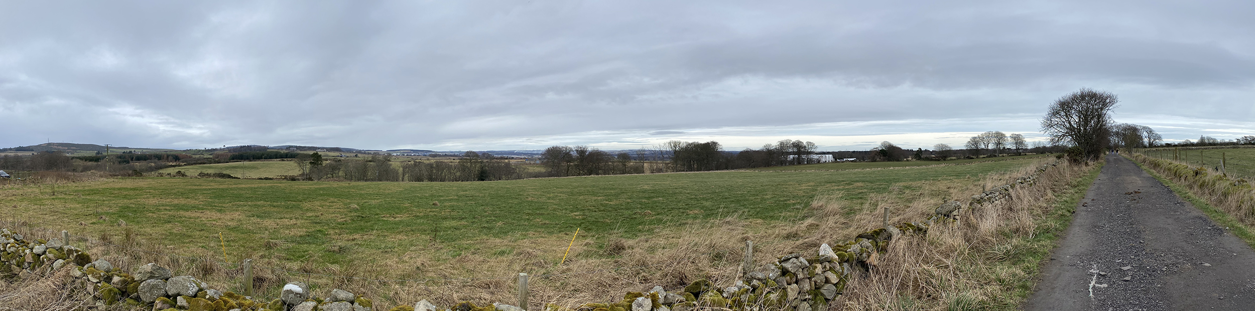
The site cover covers some 73.6ha (182 acres). With the exception of the industrial site around Bucksburn House on the northern boundary of the site, which is owned by Enermech, all of the land is owned by Aberdeen City Council. It comprises an area of undulating agricultural land (with the exception of the two schools and Enermech premises) containing a number of fields divided either by fences, walls or hedges, with clustered areas of trees. Those clusters include more densely-grouped areas of woodland along the site boundaries. The east of the site is defined by Davidson Drive and the adjoining areas of Northfield, Middlefield and Cummings Park. The north boundary is defined by the Bucks Burn at its lowest point, where there is an existing woodland corridor which wraps around Bucksburn House (Enermech’s premises). Rising from the Bucks Burn, the site slopes gradually downwards to the south, with the south boundary defined by playing fields which separate the site from Sheddocksley. The west boundary is defined by a series of field boundaries and tracks.
The site has been identified for a residential-led mixed use development since 2012. It is allocated within the adopted Aberdeen Local Development Plan 2017 as Opportunity Sites OP28 for around 120 homes and Opportunity Site OP33 for around 1,350 homes.
The site is also subject to an approved Greenferns Development Framework 2018, guiding the general layout and form of development that would be suitable for the site.
Aberdeen City Council is now in a position to progress an application for Planning Permission in Principle for Greenferns, which will pave the way for the delivery of a sustainable, residential-led development.
This consultation is the latest stage of the site’s development, being undertaken in support of a forthcoming application that will seek Planning Permission in Principle for development of the whole site and for the preparation of a detailed masterplan for an initial phase of development.
Why is a masterplan proposed for Phase 1?
A masterplan is proposed to ensure that a high quality layout, siting and design is achieved in the first phase of development, with the aim of setting a high standard for the rest of the site. The masterplan will help support planning decisions on future applications seeking Approval of Matters Specified in Conditions (i.e. conditions of the Planning Permission in Principle).
What type of homes will be provided?
Approximately 1,650 homes are proposed across the whole site. Around 350 homes in Phase 1 of the development are proposed as social housing, to be delivered by Aberdeen City Council. At this early stage, we are still designing the development but it is expected that a range of homes will be provided to meet different needs and demands. In the first instance, Planning Permission in Principle shall be sought. Full details of layout, siting and design of the development would then be provided in support of future applications for Approval of Matters Specified in Conditions (i.e. conditions of the Planning Permission in Principle).
Will the homes be affordable?
Phase 1 of the development is proposed as social housing, to be delivered by Aberdeen City Council. Additional affordable housing would be expected in the remaining phases of development, which would be required to comply with affordable housing policies in the Local Development Plan.
Will there be any community facilities or shops?
Yes, it is envisaged that amenities would be focused in the proposed neighbourhood centre, but there is scope to propose convenience retail and community facilities elsewhere in the site. We would welcome your views on the type and location of amenities that you would like to see in the development.
Where will the access be?
The exact position of new accesses is still being determined but it is envisaged that access would be taken from a combination of Davidson Drive and Howes Road. New routes would also be proposed through the site as part of the proposed internal road network.
In addition to vehicular access, a number of pathways are proposed to ensure the site is effectively integrated with existing neighbouring areas. This would also ensure that the site is more readily and safely accessible for pedestrians and cyclists.
Where will children living in the development go to school?
Primary-aged children in the development would attend a combination of Heathryburn School and Westburn School. Secondary-aged children in the development would attend Northfield Academy.
Will there be new open space provided? If so, what kind and where?
The provision of open space will be closely linked to requirements of the Greenferns Development Framework. However, the layout and design of open space is being explored as part of the current masterplanning exercise. It is envisaged that green corridors across the site would make up the majority of open space but a range of open space types would be provided, including areas suitable for recreation which also provide opportunities for biodiversity enhancement, the management of surface water run-off and the mitigation of flood risk. The layout and design of open space will take influence from similar developments across the UK that have been successful. We would also like to know the kind of open space that you would like to see provided in the development.
How is additional traffic generated by the development been considered and planned for?
The planning application will be accompanied by a Transport Assessment report, which is being prepared as part of the ongoing design process. That report will include estimates of the traffic generation of the development, surveys of the existing road network and an analysis of the operation of the surrounding junctions. That analysis will identify if any measures are required to improve the operation of nearby junctions (for example by widening them or converting how they are controlled) and full details of any such measures will be included in the report.
Are existing paths being preserved?
The retention and expansion of existing pathways and cycle routes is a key aspect of the proposal; which Aberdeen City Council has been committed to with the design team. Linking up neighbouring areas is an important objective of this development – the goal certainly isn’t to provide a large-scale development that would block of use of the land or access to neighbouring areas across the land. The goal is instead to improve access but it is not envisaged that neighbouring areas would be physically “joined up” with new blocks of development and roads. Instead, link-up would be provided with pathways and cycle routes, with existing woodland and tree belts respected.
How is wildlife being protected in the development?
As part of the planning application, an Environmental Impact Assessment is being undertaken. This will involve detailed ecological surveys by specialists to determine the location and nature of any protected wildlife on the site (such as badgers, for example). The approach would then be to prioritise development away from particularly sensitive areas and to provide mitigation measures to ensure minimal disruption to habitat. Any works that affect protected species would also likely requiring licensing from Nature Scot, which is a separate legal process to the planning application.
Is this site green belt?
The site has been identified for a residential-led mixed use development since 2012. It is allocated within the adopted Aberdeen Local Development Plan 2017 as Opportunity Sites OP28 for around 120 homes and OP33 for around 1,350 homes. The allocation of the site has been the subject of public consultation for over a decade.
The site is also subject to an approved Greenferns Development Framework 2018, guiding the general layout and form of development that would be suitable for the site. This document was subject to public consultation.
Aberdeen City Council is now in a position to progress an application for Planning Permission in Principle for Greenferns, which will pave the way for the delivery of a sustainable, residential-led development.
This consultation is the latest stage of the site’s development, being undertaken in support of a forthcoming application that will seek Planning Permission in Principle for development of the whole site and for the preparation of a detailed masterplan for an initial phase of development, containing affordable housing.
Why are there already workers on the site and areas closed off?
These workers and closed-off areas are related to ongoing survey and investigative works, which are being undertaken as part of the design process to consider important matters like drainage, ecology and soil conditions, for example. No formal works associated with the actual development have taken place, such as the laying of foundations, pipework, or basecourses for new roads and pathways.